The goal of mbquartR is to provide an easy way to download the Manitoba Original Survey Legal Descriptions data from DataMB and then to locate quarter sections, and other land division types, in the province of Manitoba. You can search by legal land description (e.g., NE-11-33-29W1) or by lat/long coordinates (e.g., -101.4656, 51.81913). There is also a convenient map function that plots the centres and outlines (polygons) of the quarter sections on a map.
The Manitoba Original Survey Legal Descriptions data set covers the entire province of Manitoba and there are over 900,000 parcels of land that have a legal land description. mbquartR was created for those who work with geospatial data in Manitoba, particularly those who are working with rural or farm parcels of land where the legal land description is commonly used as the method of identifying the location. mbquartR also allows users to quickly go back and forth between geographic coordinates and the legal land description. Most mapping applications (e.g., Google Maps) can not find or route to a legal land description, but you can with coordinates!
Checkout the mbquartR website for vignettes/code examples.
What is a quarter section?
A quarter section in Manitoba is a land unit measuring 160 acres (~64.8 ha), representing a quarter of a square mile. It originates from the Dominion Land Survey system, introduced in the late 19th century to organize the European settlement and colonization of Western Canada. The grid system covers most of the province of Manitoba and organizes land into a hierarchy of quarter sections, sections, townships, and ranges.
Data Sources
The full list of quarter sections and coordinates are downloaded from DataMB. Note that occasionally this site is unavailable, in this situation an archived version of the data is downloaded from the package repository on GitHub.
Installation
You can install the development version of mbquartR like so:
# install.packages("devtools")
devtools::install_github("alex-koiter/mbquartR")
Where is Manitoba?
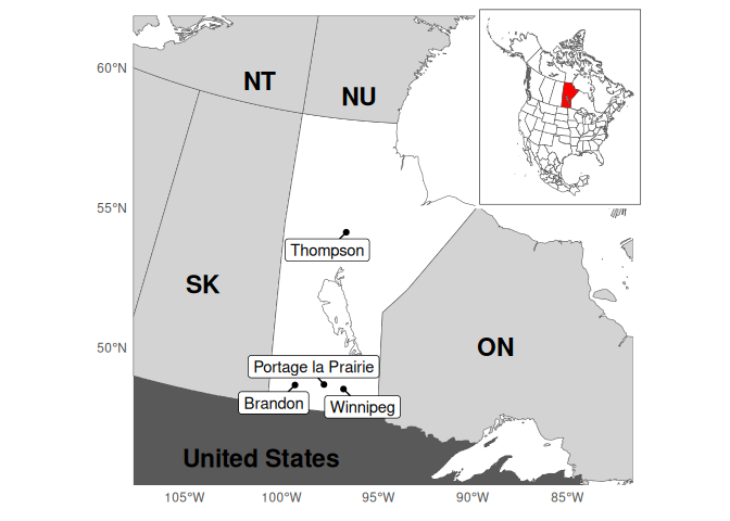
Location of the province of Manitoba and surrounding provinces and territories of Ontario (ON), Saskatchewan (SK), Nunavut (NU), and Northwest Territories (NT) within south-central Canada. Manitoban cities with a population greater than 10,000. Inset: Location of Manitoba within North America
This package is primarally maintained by:
Alex Koiter (koitera@brandonu.ca; @alex-koiter) Brandon University
Department of Geography & Environment
Brandon, Manitoba
Canada
Access Constraints
The data is publicly available through the DataMB, the province of Manitoba’s public open data platform. The usage of this data is subject to the OpenMB Information and Data Use License.
Contributions
All suggestions are welcomed, big and small, on how to make this package more robust, functional, and user friendly. Please read the contributing guide to learn more.
Code of Conduct
Please note that this project is released with a Contributor Code of Conduct. By participating in this package development you agree to abide by its terms.